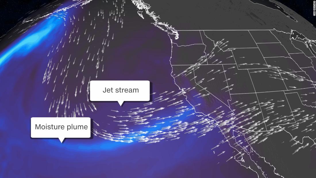
“This is a blockbuster winter storm for us,” said Mark Deutschendorf, a meteorologist with the National Weather Service in Reno, Nevada. “It is not recommended to travel from Tuesday to Friday through the Sierra and Lake Tahoe area, including western Nevada. If you venture outdoors, be prepared to spend a long period of time in your car.”
A dramatic change in the scenario will occur when winter comes at a high speed.
The foothills could see 15 to 30 centimeters of snow, while the mountains could see 3 to 5 feet. In some areas, the forecast is up to 7 feet on Sierra Nevada’s preferred terrain by Friday.
Ridgetops in the Sierra could see gusts of more than 125 mph.
Atmospheric rivers are long, narrow regions in the atmosphere – like rivers in the sky – that carry water vapor, according to the National Oceanic and Atmospheric Administration.
“The Owens Valley (Great Basin Desert) could receive almost record amounts of snow over a two-day period. Its previous 48-hour snowfall record was 23 inches back in 1969,” said NWS meteorologist Jenn Varian to CNN.
Atmospheric river creates potential for flash flooding
As the atmospheric river points its fire hose along the central coast, excessive rainfall of 10 to 20 centimeters threatens flooding in the region.
San Francisco had an average of 4.19 inches of rain in January. Suppose the atmospheric river concentrates the strongest rain in the entire bay area: In this case, it is possible that the city will receive a month’s worth of rainfall in just a few days.
Depending on the precise positioning of the atmospheric river, coastal locations south of San Francisco to Santa Bárbara can obtain between 5 and 10 inches of rain with locally larger amounts. Likely, but still significant, 1 to 2 inch rains from Los Angeles to San Diego.
Ongoing evacuations as the risk of debris flows increases
Intense forest fires can compromise the soil structure, making the sloping terrain more vulnerable to debris flows and landslides during heavy rains.
If enough rain falls on a recent burn scar, a torrent of mud, rock and debris can cascade and put communities in danger. Properties directly affected by recent fires or those located directly downstream of the burning areas are at greater risk.
Storms can alleviate current drought conditions
Although atmospheric rivers can be dangerous, residents depend on them to bring beneficial precipitation to the region.
The winter snowfall in California, fed in part by atmospheric rivers, is crucial to the state’s water supply. Warmer spring temperatures melt snow and fill reservoirs, so fresh water is available during the driest summer months.
This AR event can be seen as a much-needed relief because the current state-wide snow layer is only 40% of the average so far.
This storm, along with a forecast of an active weather pattern in early February, will help to alleviate drought conditions in California and the Great Basin.
Severe drought conditions cover almost 80% of California.
However, like anything in moderation, it is possible to have too much of a good thing.
This ‘climate lash’ will happen more often
Drastic changes from extremely humid to extremely dry and vice versa will be almost twice as likely, occurring on average once every 25 years, by 2100.
