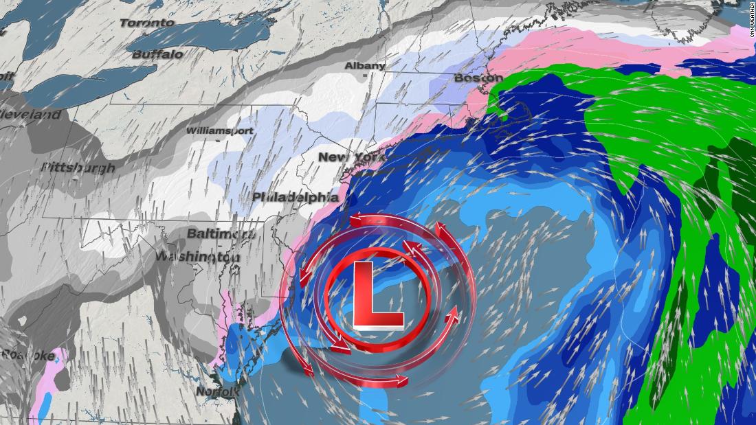
It has been almost two years since Washington, DC had a snowfall greater than 1 inch, but that could change dramatically on Sunday. The city is under winter storm warning until Sunday night, with 4 to 20 centimeters of snow possible. More snow is likely to fall on Monday.
“Predicting the value of snowfall in the nation’s capital is rarely easy, but confidence is growing that the DC area will see significant snowfall on Sunday and will last until Monday,” said CNN meteorologist Taylor Ward.
A major winter storm is underway and could bring up to 25 centimeters of snow to the country’s capital. That would end the 709-day streak Washington, DC went through without a snowfall greater than 1 inch.
“The only other time this happened was in a 788-day sequence that ended in 2013,” said CNN meteorologist Brandon Miller.
The storm path
On Sunday morning, more than 100 million people were alerted by the winter weather from the southern Great Lakes to New England. The impacts of the storm were already felt when heavy snow fell in northern Illinois and central Indiana, causing travel headaches.
The storm will become a powerful Nordic on Monday morning when it reaches the coast. This will be a long-term event for many along the east coast, as the system will take time to leave. Snow will fall in regular bursts over the next three days, from DC, Philadelphia, New York to Boston, gradually ending from the southwest to the northeast.
Main expected impacts
Strong winds will accompany heavy snow, reducing visibility and creating power outages. Travel disruptions will be extensive from ground to air, as the storm covers roads and tracks with fresh snow. Snowfall rates of 1-2 inches per hour have been reported near the Chicago suburbs on Saturday night, where up to 9 inches of snow are forecast for Sunday night. As the storm moves east, it reorganizes and intensifies. The largest accumulations of snow will occur from New Jersey to the south of New York, eastern Pennsylvania and parts of Maryland, where up to a foot of snow is possible.
The accumulation of ice and hail is also a concern for parts of North Carolina, Virginia, Maryland and West Virginia. The higher totals are likely to fall north of Charlotte and Raleigh, where up to 1/2 inch of ice is possible.
The hot section of this storm is creating countless rains and storms embedded in the central and southeastern United States today. Expect a rainy Sunday in Atlanta before the rains leave the region at the beginning of the work week.
The more westerly areas, such as St. Louis and Springfield, Illinois, will see another mix of rain and snow during Sunday night. The exact amount of snow that will stick to the ground remains uncertain.
A week after the Iowa areas were hit by snow, Hawkeye State was able to see a few inches more on Sunday night.
A developing Nor’easter
“The snow will move from the southwest to the northeast on Saturday night and early Sunday morning, with snow likely to be spreading mid-Sunday morning,” said the National Weather Service office in Baltimore and Washington, DC .
From Sunday afternoon to Monday, there is the possibility of a change to hail and freezing rain.
With any nor’easter, there is uncertainty in the predicted snow totals because much depends on the exact low pressure path.
“There seems to be a consensus among the forecast models that moderate to heavy snow will occur from parts of Virginia to Pennsylvania and New Jersey, but there remains some uncertainty about the exact path of low pressure Monday through Tuesday,” said Ward . “This will have a significant impact on the amount of snow that falls from New York City to New England. A storm system parallel to the coast would provide greater snowfall, while a trail further east to the sea would limit the total snowfall. in New England. “
This can make the difference in places like Boston and New York between seeing 10 centimeters of snow or 30 centimeters.
The NWS Philadelphia office is forecasting more than 15 centimeters of snow with gusts of up to 72 km / h, “creating a significant amount of blown snow”.
NWS’s Boston office had already suggested the storm and its possible effects on Friday.
The storm will then drive off the coast on Wednesday.
Jennifer Gray of CNN contributed to this report.
