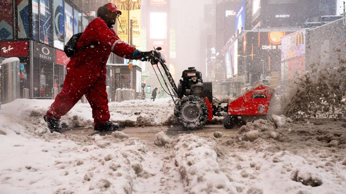
The combination of heavy snow, gusts of wind and coastal flooding should make travel anywhere from dangerous to impossible in much of the region on Monday and can interrupt power in a large area.
“I want New Yorkers to hear me loud and clear – stay home and off the road,” New York Governor Andrew Cuomo said in declaring a state of emergency for 44 counties.
This could be a historic snowstorm. As of 1 pm Central Park had recorded 13.3 inches of snow (8 inches in the past 6 hours) and it was still snowing, the National Weather Service said. CNN forecasters say it is possible for about half a meter of snow to cover the city before the storm passes.
Covid-19 clinics in New York, New Jersey, Philadelphia and elsewhere in the region were closed on Monday because of the storm. De Blasio said the appointments can be rescheduled and New York will be able to update itself “quickly”.
The storm also affected air traffic.
LaGuardia airport canceled all commercial flights on Monday. By the end of the morning, 83% of JFK flights were canceled and more cancellations are expected. In Newark Liberty, 75% of flights were canceled and the AirTrain service is suspended.
The hardest hit places
New York City
The snowfall, which started on Sunday night, increased in intensity on Monday, and snow rates can reach 5 to 7 centimeters per hour in the city, Long Island and southern Connecticut. This could create conditions of zero visibility and make the trip very dangerous.
The city’s traffic authority suspended the open-air metro service as of 2 pm on Monday.
The buses are still operating, but the city and state are monitoring the situation closely, said Sarah Feinberg, acting president of the New York City Transit Authority.
Empty or tandem tractor trailers are not allowed on bridges and pedestrian walkways on some bridges are closed.
Students in the municipal school system will have classes remotely until Tuesday, said de Blasio.
“It’s a little challenging,” said Debra Paul, an East New York resident. “The gentleman had to hold me, because I was getting up off the floor.”
The storm can drop up to 21 inches when it ends. If that happens, it will be the largest amount of snow New York City has seen since January 22-24, 2016, a storm that poured 27.5 inches over a two-day period. It would also consolidate this storm as one of the most prolific winter storms for the city, placing it in the top 10 of the highest snow totals ever recorded.
Washington DC
The city has already seen 2-3 inches of snow, ending a run of 710 consecutive days without an inch of snow or more, the second longest in the city dating back to 1884.
On Monday, precipitation changed to a mixture of hail and snow, covering the roads with ice and increasing the danger of driving. There is a chance of light snow on Tuesday morning, before ending in the afternoon. The district has managed to see a total of 5 to 7 inches, the maximum in the past two years.
Philadelphia
A similar combination of rain and snow hit Philadelphia, where two to three inches of snow fell early Monday.
A mix of rain and snow in the morning is likely to snow again from Monday night to Tuesday. The expected final total is about a foot.
Boston
A winter mix starting on Monday night will continue all day on Tuesday, snowing again on Tuesday night. The National Meteorological Service said road conditions would deteriorate rapidly around midday on Monday.
Boston is used to significant snowfalls, having alerted teams to plow 2,000 miles of lane on city roads by Tuesday.
This is equivalent to the distance from Boston to Denver without snow in less than 48 hours.
The location and tracking of this multi-day storm will play an important role in total snowfall across the Northeast. A storm near the coast will produce more rain, while a storm far from the coast will reduce humidity and lead to less snow.
The models suggest that this nor’easter should be the ideal spot for abundant humidity that leads to significant snowfall. Another important factor is also at stake, increasing confidence for the impacts of the storm.
According to CNN meteorologist Tom Sater, this storm is hitting Canadian cold air. “A strong high pressure system is installed in southeastern Canada, pushing enough cold air to the south long enough and lasting long enough to get the type of snow predicted.”
Storm story
Nearly 75 million in a dozen states are under some kind of winter surveillance or warning of a storm that had its genesis in the Midwest on Saturday. While there, the storm dropped more than a foot of snow in Milwaukee.
Correction: an earlier version of this story had the wrong first name for the governor of New Jersey, Phil Murphy.
